We read all the reviews describing the Tongariro Alpine Crossing — New Zealand’s #1 Day Walk and TripAdvisor’s #1 of 700 activities on the North Island; A life-changing experience not to be missed! (Lonely Planet); Lava flows, an active crater, steam vents, emerald-coloured lakes and magnificent views combine to make this an unforgettable walking journey.
We’re right here. Is this something we should do?
We studied the guidelines:
- For the moderately fit and healthy (Frank swims every day. He’s had some issues with his knee but keeps it steady with a brace. I can walk forever.);
- You may feel oxygen deficiency (Frank and I have never had issues with this);
- Be prepared (We both have sturdy shoes, we could pack water, food and extra clothes in our back packs).
Finally, we studied reviews of people who had done it: Some challenging steep parts but you have never seen anything like this!; As a pretty fit 60+ year old (and I saw a good few more during the day!) I had a genuine sense of achievement when I completed the trek; Seriously an amazing walk, with every step worth the view at the top; Being of a moderate fitness level I found it challenging but not impossible and never felt like I wouldn’t be able to do; 10/10!!
We batted it around some more. Could we handle a 12-mile walk? If we did, we could go early because it might take us longer than the 7 to 8 hour estimate. It looks incredible. It doesn’t sound too hard and we did that one big hike in Colorado, etc. etc. In the end, we decided to go for it. Frank double-checked his handy dandy weather app — sunny and warmer. Tomorrow would be the day we would hike the Tongariro Alpine Crossing!
Note to self: When you need to talk through a decision for days to figure out if you should or shouldn’t do something, don’t. Thank goodness for the pictures because today (the day after the hike), all I can remember is that yesterday we did the stupidest thing we’ve ever done . . .
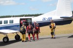
We headed out for the one-hour drive at 5:30am. Having chosen the option of leaving our car at the lot at the end of the trail, we took our pre-arranged shuttle to the trailhead. It was a little chilly but Frank and I were prepared and ready to go!
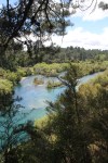
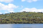
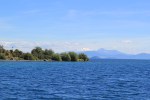
Although there were many people on the trail, the leisurely hike through the Mangatepopo Valley was quietly peaceful. We walked along a meandering stream surrounded by lava fields and lush vegetation. Majestic Mount Nguaruahoe was our backdrop as we walked along a meandering stream surrounded by lava fields and lush vegetation. The path was wide, easy to follow, even boardwalked in spots. The rising sun warmed the air and we soon shed a layer of clothing. We were so glad we decided to do this today!
As the valley rolled into a gentle climb, the vegetation became more scattered and the lava more prevalent. A group of portable toilets signaled our arrival at Soda Springs and the impending challenge ahead – 200m (or 656 ft) up the Devil’s Staircase. Quite aptly named, it was, how shall I put it(?), Hell. While Frank nimbly climbed the uneven track and accompanying steps, I huffed and puffed and climbed and rested, then huffed and puffed and climbed and rested. He waited for me and encouraged me until we finally reached the ridge of the South Crater. The views were beautiful but the fact that I could see the hikers below and realize how far I’d come gave me the push I needed to forge ahead.
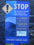
South Crater turned out to be my “happy place.” For 15 glorious minutes, the trail was completely flat. I regained my breath as we reached a sign signaling the point of no return. STOP! Are you really prepared to continue your alpine crossing trip? Having regained my mojo, I was ready to rock n’ roll. The next section was described as difficult but short, with a time estimate of less than an hour. And then we would be at the top!
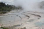
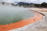
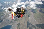
Difficult ascent? Try impossible ascent. The uneven, boulder-y track was steep with big drops off on both sides. Add a strong, chilly headwind and you get crazy SCARY! We had to figure out the best rocks to climb on and then hope they weren’t loose. One small section had a chain attached to the side of the hill to grab on to – the best part of the trek. It was well over an hour and a half of terror before we collapsed with exhaustion at the top of Red Crater Ridge. At 1,886m (or 6,187 ft), this was the highest point of the trek, as well as the halfway point. The crater, itself is stunning with its vibrant coloring. The sulfur smell makes you aware that the crater is still active. (We saw many signs warning of potential volcanic activity.)
We celebrated reaching the summit with lunch, thinking “It’s all downhill from here!” Little did we know…
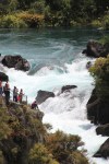
We wandered over to the other side of the ridge. Below us, in the Central Crater, we were awed by the view of the vivid Emerald Lakes. What we saw next awed us even more — the path to get down to the lakes, our path, was straight down! The map said Easy Descent. The website which I am reading now says, “The descent from Red Crater requires some coordination and balance due to the volcanic ash and scree underfoot. From this point you will be descending just over 1000m in altitude most of which is a good steady gradient.” Can you say “Major understatement?!!!” Frank estimated the vertical drop at 200 yards. The ground was loose and those of us (95%) who didn’t have hiking poles were slipping and falling with each sliding step. I tried going down on my bum but the rocks were jagged. I tore my pants (providing a view of my right cheek to the hundreds who passed us later in the hike!). It was worse for Frank. He fell hard and dislocated his shoulder, rendering it nearly impossible to keep his balance for the remainder of the hike. He had expected some discomfort from his knee (particularly on the descent) but adding the shoulder to the mix was brutal.
As much as Frank waited for me on the way up, the roles were reversed on the way down. I could tell he was in intense pain with every step. The uneven track was torturous, a crossover of a rocky creek terrifying. We took our time.
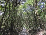
After a climb to the North Crater, followed by a zig-zagging trail down the mountain, we reached the Ketetahi Hut (bathrooms) around 3:45pm. A sign told us it was only(?!!) two hours more to the car park. Who’s idea was this?!!
We had to finish. One step at a time. We walked and walked, resting on each large boulder we encountered. The brush turned to trees and at last we came to an opening with a sign – the carpark?!!! Umm, no. The sign said 45 minutes to the car park. In two hours, we had only come half way!
If you’ve ever had knee problems, you know that the only thing worse than going downhill is going down steps. Well, that’s what the remainder of the trail was made up of. Slowgoing, it was steps, uneven trail, steps, uneven trail. Will this trail ever end? Every time we went around a corner, there was another series of steps or another long, rocky path through the woods. The number of hikers passing us by dwindled. It was getting late.
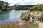
Alone on the trail, we came to a fork with a sign: a symbol of two people, one with a periscope. I assumed it meant “lookout” so we followed the other path. After walking for a while, I began to second-guess my choice. What if it meant something else and I’ve made us walk all this way for nothing? I checked my phone and as expected, we didn’t have any service. The trail app I had downloaded didn’t work either. What if it gets dark? Panicking and praying, I left Frank to amble along, while I hurried ahead down the trail. Tears formed as I rounded a corner and saw the open space of the car park. I ran back to Frank, “We made it! It’s just around the corner!” Twelve and a half hours from when we started, we were finally sitting in our car driving home.
The Tongariro Alpine Crossing. New Zealand’s #1 Day Walk and #1 of the must-dos on the North Island? Yes. The sights were indeed spectacular (now that I look back on the pictures!) and the HIKE — not walk — is a definite must do for experienced hikers or athletic and fearless twenty-somethings. Life-changing? I have just removed hiking Kilimanjaro from my bucket list. Unforgettable? Most definitely.
-
-
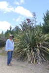
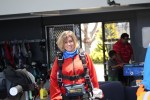
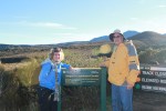
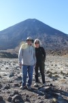
7:15am: All prepared and excited to begin the Tongariro Alpine Trail
-
-
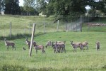
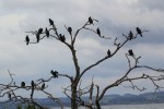
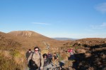
There were many people on the trail as it was a beautiful day.
-
-
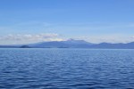
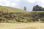
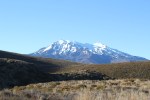
Frank’s favorite, Mount Ruapehu, rose behind us.
-
-
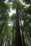
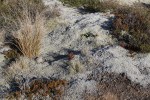
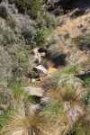
Interesting vegetation
-
-
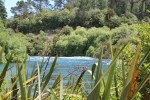
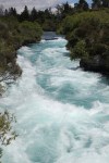
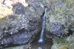
A meandering stream
-
-
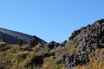
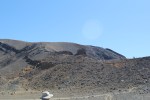
Lava fields
-

-
The morning sun rose over the mountain, warming the air.
-
-
We removed our jackets and enjoyed the walk through the valley.
-
-
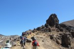
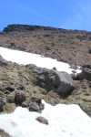
Point of no return before beginning the Devil’s Staircase.
-

-
One section of . . .
-
-
the Devil’s Staircase.
-

-
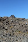
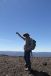
We made it!
-

-
Hiker’s had the option of adding on the steep trek to Mt Ngauruhoe. We passed.
-

-
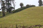
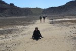
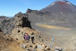
The flat South Crater
-
-
My happy place.
-
-
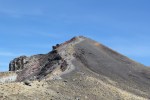
The steepest part of the trek along Red Crater Ridge.
-
-
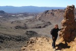
Halfway up Red Crater Ridge.
-
-
One foot in front of the other!
-
-
Up we go…
-
-
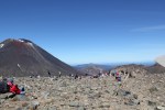
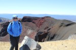
The summit of the trek at the top of Red Crater, where many, including us, took a break for lunch.
-
-
We made it!
-
-
It was soooo windy and chilly!
-
-
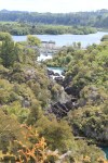
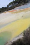
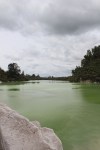
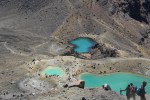
The Emerald Lakes below were so beautiful . . .
-
-
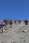
but the hike to get there? Not so pretty! (This is 1/3rd of the way down!) The ground was loose and everyone was slipping.
-

-
-
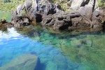
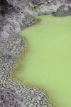
The short climb to Blue Lake.
-

-
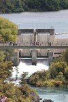
Blue Lake.
-
-
-
-
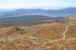
The zig zagging descent seemed to go on forever.
-

-

-
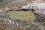
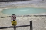
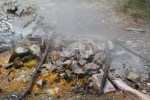
The whole area is a hotbed of geothermal activity and there were many signs warning hikers to be on the lookout for volcanic activity.
-
-
Couldn’t believe we still had so far to go til the end.
-
-
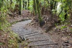
Countless stairs,
-
-
a never ending trail.
-

-
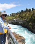
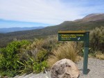
The Ketetahi Car Park, aka Nirvana.